Flying that little J3 Cub to the 1840-foot long, 30-foot wide runway at Clearview Airpark in Westminster, Maryland, I quickly learned to watch for squirrely winds and descending air on short final to runway 31. It was never strong enough to dash me into the weeds, but it did (aside from giving me an itchy throttle finger) make me aware that not all breezes are friendly. One should always be trying to read as much as possible into the air we fly through… case in point: low-level wind shear.
THE STORYBOARD
During a stabilized approach, you encounter a suddenly decreasing headwind. Seeing the airspeed drop and the world rising in the windshield, you add power and raise the nose. You overcompensate, perhaps a little hot and high, but adapt in time and land normally. Or, during a stabilized approach, you encounter a suddenly increasing head wind. The airspeed indicator momentarily rises and the aircraft balloons. The pilot reduces power and points the nose down. When the gust stops, the airplane (in its high-drag configuration, nose-down and power off) has been slowed to nearly a stop… and drops. Yes, people die this way — in airliners and small planes alike.
 WHAT IT IS
Low-level wind shear is defined as any sudden change in wind speed or direction — horizontally or vertically — under 2000 feet AGL. Wind shear can exceed an airplane’s capabilities and those of its pilot. It strikes when we’re most vulnerable: low (reduced room to rectify the situation), and, higher drag (less maneuverability to rectify the situation), higher workload (less capacity to rectify the situation). It can occur with no visible warning, when it isn’t expected, and in the absence of convective weather. Several early papers of the American Meteorological Society on low-level turbulence, gusts, and downdrafts date back to the early 1950s. (I did come across one TWA technical bulletin on the effects of wind shear, along with suggestions on ways to avoid it, dated 1961.) But it wasn’t until the early 1970s that tools to analyze wind shear or gust fronts, and monitoring systems to warn us about them, became more widespread.
WHAT WE KNOW
Wind shear can be horizontal or vertical, and usually occurs because of large temperature or density gradients. It can come about due to thunderstorms, frontal activity, inversions, or simply surface obstructions. It can be innocuous, like the light chop we’ve all flown through in the mild shear zone between layers of air moving at slightly different velocities, or gusting winds (mini-wind shears) when the wind sock is doing the macarena. It can also be a rocket ride. In a recent iPilot poll asking just what sort of ride, 38% had been “surprised” by wind shear, but hadn’t experience any loss of control; 46% had encountered enough so that they had to quickly compensate to avoid a loss of control; six percent had found their aircraft momentarily out of control, and ten percent had an accident or incident to show for it.
SHEAR FACTORS
Although it can show up without thunder and lightning, wind shear does have some well-known associations with thunderstorms. Shear can also cause updrafts to tilt enough so that they dissipate (destroying convective potential) or it can also yank a shaft of precipitation from the updraft summit and even introduce rotational energy. Thunderstorms having a more erect appearance usually don’t last as long as those occurring in a sheared environment, as the rain usually chokes off the updraft, as we learned in ground school regarding the standard stages of thunderstorm development. There are many airflow factors used to determine the potential severity of wind shear.
- Thunderstorms: updrafts and downdrafts. Usually we think of unstable air (and formation of thunderstorm clouds) in terms of updrafts, but air can be stable or unstable going up and down.Example 1
-
- : When low-level air is dry, but moisture exists at higher levels, strong downdrafts can grow through evaporative cooling and precipitation. The result can be a dry
microburst
-
- . This occurs more frequently above higher terrain, out west.
Example 2
- : The heavy rain and hail common to the familiar strong updraft storms in unstable moist air (where there is much less dry air and thus downdrafts driven by evaporative cooling), is the type more familiar to easterners.
-
- Frontal wind shear usually occurs when there are steep wind gradients. If you see a temperature change of more than five centigrade degrees across the front, and it’s moving at a good clip (30 knots or greater), be wary of wind shear — especially if you see it coming and plan a landing nearby.
- The ‘outflow’ phenomena: the proverbial and sometimes prodigious downburst, such as the dramatic depiction at the start of this article. Downdrafts from thunderstorms can overcome even turbine power, and when they hit the ground, they spread out. For the defending pilot, this greatly complicates matters. That blast of cool air you’ve felt before a storm hits, called a “first gust”, is a warning if you’re on the ground. In dry areas, when thunderstorm outflow winds stir up a wall of dust, it’s called a haboob (and no, I didn’t make that up, click through to see one). If you’re flying, winds can change by an amount equal to or even greater than the approach speed of small aircraft, as far as 10 miles ahead of any visible line. Most of that change occurs in the first 150 feet above ground, so a routine approach can turn into an emergency recovery in less time than it took you to read this paragraph.
- Macro- and Microbursts. Anything greater than two and a half (statute) miles in diameter is a macroburst. Anything smaller is designated as a microburst. These in particular are what often cause hazardous conditions during approach or departure.
- Dust devils. If you live in the desert southwest, you’ve probably seen one of those miniature tornadoes. They usually form on breezy, cloudless, but hot days, when differential heating of the ground creates a bubble of hot air. If any turbulence imparts rotational energy, it forms a vortex similar to water going down a drain (only upside-down). They usually grow no larger than 20 feet across and 100 feet tall. However, the right conditions can spawn giant dust devils that tower a half-mile high and pack winds whirling as fast as 90 miles per hour.
Still more ways to pull the rug out: Temperature inversions, such as those caused by overnight cooling in the southwest, can also dissipate or lower the level of the shear zone from high winds aloft, resulting in large changes in wind speed and direction in only a few minutes. Surface obstructions such as buildings near a runway obviously contribute to winds that conspire against a smooth arrival, but so can nearby terrain, especially mountains. The same phenomenon you see when a down-flowing stream levels off, and the water cascades upward (known as a “hydraulic jump”) happens with air. The only difference is that we can’t see it. But we should learn to anticipate it.
DEFENSE: Your only salvation is to always anticipate the worst, have an engine with little or no “spool-up time” (which most of us do), and be spring-loaded to go around. If your approach doesn’t look so good, but the weather does, imagine how it might look after a wind shear event and go around. Clear weather is not a good reason to fly a bad approach.
EXTREME WEATHER WARNING SIGNS
- If you see a lowered wall of clouds with even lower detached scud or tail clouds (which may contain rotational motion), stay away.
- If you see any low, ragged, concave shaped bottoms of cloud formations that look like shelves, don’t get closer.
- If you see a rapidly developing hole and area of dissipation in the clouds, retreat!
- If you see an area of virga, which is rain that doesn’t reach the ground (or any area of intense rainfall), unless you know it’s totally harmless (as in the photo, below), steer clear.
- If you see a line or ring of dust clouds traveling along the ground, land somewhere else.
- And if you see a dust devil this big near where you’re about to land or take off… don’t.

BOTTOM LINE: The weather does not care if you’re a really nice person, or how good a pilot you are. If you don’t respect it, it will kill you.
FAA pamphlet 8740-40
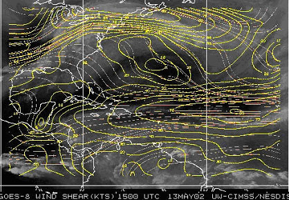
Web sites for wind shear imagery
For the East coast (West Atlantic):
http://cimss.ssec.wisc.edu/tropic/real-time/atlantic/winds/wg8shr.html
–and from GOES-10, for the West coast (East Pacific)
http://cimss.ssec.wisc.edu/tropic/real-time/eastpac/winds/wg9shr.html